
Bremerton ZIP Areas at a Glance
The working set for a Bremerton ZIP code directory is 98310, 98311, 98312, 98314, and 98337. Official city material also contains responses from 98367 and 98383, but those codes belong to neighboring Port Orchard and Silverdale postal geography. They should not be labeled as Bremerton city coverage. USPS assigns delivery codes, while the city and county maintain other boundaries.
| ZIP | Area tied to Bremerton | Post office or type | Search caution |
|---|---|---|---|
| 98310 | East Bremerton, Manette side, and nearby county communities in postal descriptions | Standard Bremerton-area ZIP | Not the same as the city line |
| 98311 | East Bremerton and Sheridan Park area | Standard ZIP | Verify each delivery address with USPS |
| 98312 | West and south Bremerton plus surrounding county mailing area | Standard ZIP | Postal city extends beyond municipal limits |
| 98314 | Navy and shipyard-related Bremerton use | Specialized or restricted use | Do not infer ordinary neighborhood coverage |
| 98337 | Central and downtown Bremerton | Pacific Avenue Post Office | Official office address uses 98337-9998 |
No official Bremerton postal realignment notice was verified. Current USPS results and live jurisdiction maps are the safe sources for a present address. Never assign an old address its modern code without a dated source.
Bremerton ZIP 98337 Post Office
The USPS Bremerton Post Office page confirms the Pacific Avenue location at 602 Pacific Ave, Bremerton, WA 98337-9998. That full code belongs to the office address. It does not describe every route in the central city. Use the USPS ZIP Code Lookup for the precise street and unit rather than extending the post office’s ZIP+4 to nearby buildings.
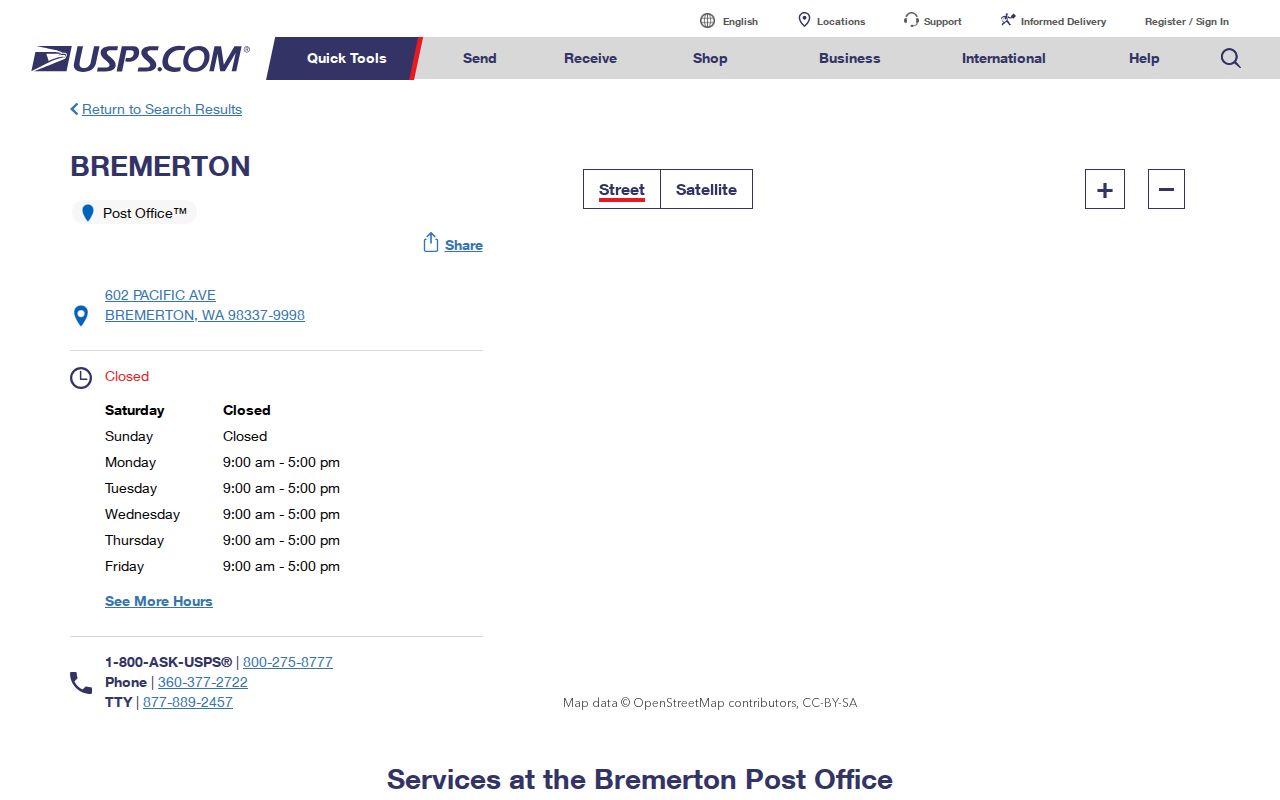
The official listing anchors the central postal area, but a parcel or city map is still needed to answer ownership, jurisdiction, and municipal-service questions.
Bremerton ZIPs and City Limits
The City of Bremerton warns that many addresses carrying a Bremerton postal name sit in unincorporated Kitsap County. That is not a records error. Postal delivery, city limits, tax parcels, and permit jurisdiction are separate systems. County parcel maps describe tax geography. Bremerton GIS checks city jurisdiction, districts, zoning, utilities, and city properties.
The mismatch changes where a request goes. A county parcel outside the city may have county permits even though its mailing line says Bremerton. A parcel inside the city may require Bremerton Community Development records. The Bremerton GIS portal and the Kitsap parcel map should be checked together.
Find Bremerton Residents by ZIP
Most local official tools do not offer a public postal-wide list of households. Parcel Details searches by parcel, site address, or mailing address, but its static landing screen does not show a ZIP filter. County GIS starts from a parcel and map layers. VoteWA verifies the signed-in voter’s own profile and is not a public postal roster. Permit Explorer documents address, parcel, jurisdiction, and date fields, not a postal-code filter.
- Confirm the complete address through the current USPS ZIP Code Lookup.
- Run the address in Kitsap Parcel Details and save the site address and parcel number.
- Check Bremerton's Jurisdiction Checker to learn whether the parcel is inside city limits.
- Use the right city or county custodian, then verify any name against the dated record.
Once the postal area has narrowed the place, use the Bremerton street directory process for the address-level chain. That separates owners, taxpayers, mailing contacts, and possible residents instead of treating every name as the same role.
Bremerton ZIP Search Fields
The official tools accept different inputs. Match the search box to the question instead of forcing a ZIP into a tool that was built around parcels. The USPS historical Post Offices by ZIP interface is useful for post-office research, but it warns that old ZIPs may no longer be current.
| Official tool | Documented field | Required? | What it establishes |
|---|---|---|---|
| USPS Post Offices by ZIP | From ZIP Code; To ZIP Code | A range is needed | Postal-office records, which may be historical |
| Kitsap Parcel Details | Parcel number; site address; mailing address | One search path | Tax parcel and address fields |
| Kitsap Permit Explorer | Address; parcel; permit type; jurisdiction; issued date | Varies by search | County permit context |
| VoteWA | First name; last name; date of birth | All three for own profile | Identity-matched voter profile |
Washington law separately requires the public sex-offender registry to support searches by county, city, ZIP, last name, and address hundred block. That safety tool is not a general resident directory and must not be used to confront, threaten, or harass anyone.
Read Bremerton ZIP Labels
Postal terms sound alike but answer different questions. A Bremerton ZIP code directory should keep them distinct. The exact route or unit can matter, while broad Census shapes are meant for statistics rather than mail delivery.
- ZIP code
- A USPS delivery code. It is not a city, neighborhood, or legal boundary.
- ZIP+4
- The basic five digits plus four digits that refine a delivery segment or destination.
- PO-box ZIP
- A code used for post-office-box delivery rather than ordinary street routes.
- Unique ZIP
- A code assigned for specialized delivery, often to a large institution.
- Carrier route
- The set of stops served by a postal carrier, which is narrower than a whole ZIP.
- ZCTA
- A Census approximation of ZIP geography used for statistics, not an exact USPS border.
Census did not produce ACS ZCTA data before the 2011 five-year release. Do not treat a ZCTA polygon as an exact historic or current route.
Bremerton Directory Boundary Outliers
City survey material includes 98367 and 98383 among broader response geography. They are useful warnings, not extra Bremerton ZIPs. The first is tied to Port Orchard and Olalla postal geography. The second belongs to Silverdale. A person responding to a city-area survey may work, visit, own property, or use services in Bremerton without residing inside the city.
The five-code working set also includes an outlier. The specialized 98314 code is tied to Navy and shipyard use, and official static material does not expose a full ordinary delivery boundary. A low count in a survey or data table must not be converted into a claim about a neighborhood. Verify the actual address.
Note: Keep 98367 and 98383 as neighboring comparison codes, not as Bremerton city ZIP coverage.
Historic Bremerton ZIP Directory Clues
ZIP codes began long after Bremerton's oldest local records. William Bremer platted Bremerton in 1891, and the city incorporated in 1901. Charleston began as Port Orchard No. 2, took the Charleston name in 1903, and later became part of Bremerton. Manette also appears as an older settlement label. Those names are better search terms than a modern postal code when reading an early directory, deed, map, or census.
The regional city-directory volumes add another quirk. They can include Port Orchard, Charleston, Manette, and, in later runs, places such as Silverdale and Poulsbo. The volume title therefore cannot prove a Bremerton address. Search the locality heading, street entry, and source year. For an old property, retain the original townsite or community name and use the parcel's legal description as a bridge to modern geography.
Confirm a Bremerton ZIP Result
A clean result preserves each system's language. Copy the USPS city and code, the assessor’s site address, the parcel number, the city jurisdiction result, and the permit custodian. If those labels disagree, explain the boundary each one measures. Do not silently choose the one that looks most familiar.
The practical flow is short: ZIP to USPS address check, then city jurisdiction, county parcel, and the record office that holds the needed file. For a records request, Washington's Public Records Act, Chapter 42.56 RCW, generally requires an agency to respond within five business days by producing, denying, or acknowledging the request with an estimate. Ask only the agency that actually holds the record.
Keep a small source log for each Bremerton result. Note the date checked, full postal line, USPS result, parcel number, site address, mailing address, jurisdiction answer, and custodian. Site and mailing fields can differ because the tax notice may go somewhere else. That difference is a lead, not proof about where the taxpayer lives. If a map and text record disagree, use the parcel identifier to reopen both sources and ask the Assessor which field needs correction. Exact parcel corners require a recorded survey or plat, since county GIS is not a legal survey.
Access does not end with web tools. Assessor information can be inspected through the county office or requested by phone or public-record route. Bremerton city records can be requested from the city custodian, while county permit records go through the county Public Records Center when Permit Explorer lacks the file. For old postal context, ask KRL or the State Library for the right directory or phone-book year. Those offline routes matter when a current address search returns nothing.
For a mailed or emailed request, state the record type and date range. Include the parcel number when known and explain whether the address is the site or mailing field. The county can then route a tax, permit, or recorded-land question to the right unit. City staff need the same care. A short, precise request avoids a broad search across records that use different geographic keys.