
Walk Bremerton Streets by Address
A useful Bremerton street directory begins with a broad address search, not a guess about the person who may live there. The Kitsap Parcel Details screen accepts a street name by itself and often returns more hits that way. Add a house number after the broad list appears. This approach catches suffix, direction, and formatting differences. The result ties the street address to a tax account and parcel, while the county map supplies nearby lot geometry. Those are firm anchors for the rest of the search.
- Search the street name in Parcel Details, then narrow with the house number and confirm the site address.
- Open the Kitsap Parcel Search Map, click the lot, and record its taxpayer, account number, site address, and mailing address.
- Check the City of Bremerton jurisdiction tools before assuming a Bremerton postal address lies inside city limits.
- Use the parcel number, legal description, and owner names in the Auditor deed index. Follow each transfer instead of treating the assessor name as title proof.
- Add permits, lawful voter-file access, and historical directories only for the specific question and date being researched.
The flow is address to parcel, parcel to taxpayer, deed to legal owner, then dated sources to occupants. Ownership and residence are not synonyms. A mailing address may be far from the site, and a directory entry only shows what its publisher gathered. Keep a source and date beside each name.
Bremerton Street Directory Search Fields
Parcel Details has three visible modes. Site Address searches the physical location. Mailing Address searches where taxpayer correspondence goes. Parcel Number, also called the tax account, searches the county identifier. The assessor says a taxpayer-name lookup is available through its records service, although the landing screen does not show a separate owner field. For help, the Kitsap County Assessor also offers inspection by phone, email, and at its Port Orchard office.
| Field | Input | Best Use | Key Limit |
|---|---|---|---|
| Parcel # (Tax Account) | Full or partial number | One known lot | Not a street address |
| Site Address | Street name, then number | Land and structure location | Does not prove occupancy |
| Mailing Address | Taxpayer mailing text | Correspondence address | May differ from the site |
| Taxpayer name | Assessor-assisted lookup | Finding parcels tied to a name | Not legal title proof |
The distinction matters on every Bremerton block. County guidance says the taxpayer of record does not establish legal ownership. The recorded deed does. Parcel details may also show assessed values, sales, exemptions, and a six-year tax receipt history, but a tax payment still does not prove that the payer lived at the site.
See the live Parcel Details screen before entering an address. Its interface shows the search modes and reminds the reader which address label is being searched.
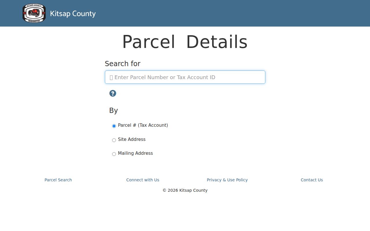
The screen is the starting point for an address chain, not a list of every person in a home.
Map Bremerton Parcels Street by Street
The county parcel map adds shape and context to an address search. Clicking a polygon exposes the taxpayer, account number, site address, and mailing address, with links to more parcel facts. Work down one side of a named street and back along the other. Record the parcel number for each target lot. Vacant land, corner parcels, and lots reached from another street can otherwise make a simple house-number list misleading.
Bremerton's own Maps and GIS page answers a different set of questions. Its portal offers Bremerton Properties, jurisdiction, zoning, district, utility, and aerial layers. County mapping is strongest for parcel and tax geography. City mapping is strongest for municipal services and boundaries. Cross-check both when an address sits near the edge of town.
- Parcel
- A mapped unit of land with its own county tax account.
- Situs address
- The physical site address, which may differ from the taxpayer's mailing address.
- Plat
- A recorded subdivision map that identifies lots, blocks, streets, and easements.
- Criss-cross directory
- An address-first or street-first directory that turns a place into a listed name.
Note: GIS lines help locate records, but the county warns that mapped boundaries are not a legal survey.
Bremerton Records Indexed by Address
No single public roll is a complete Bremerton street directory. The sources below overlap, but each describes a different legal or historical fact. Begin with the parcel and use its stable identifiers to move between systems.
| Address Record | Official Keeper | Street Evidence | Access Route |
|---|---|---|---|
| Parcel and tax roll | Kitsap Assessor and Treasurer | Taxpayer, site, mailing, sales, receipts | Web, phone, email, Port Orchard counter |
| Parcel map | Kitsap GIS | Adjacent lots and account links | Free web map and county GIS help |
| Recorded documents | Kitsap Auditor | Deeds, liens, easements, plats, surveys | EagleWeb, office, mail, copy form, Archives |
| Permits and code files | Kitsap DCD or Bremerton | Projects, dates, parcel, jurisdiction | Permit tools or records request |
| Voter registration file | Kitsap Elections | Lawfully disclosed address fields | Request subject to state limits |
| Historic directories | State Library and KRL | Listed adult at an address in a given year | Catalog, appointment, local reference help |
Online access is only one channel. Auditor Recording accepts phone and email questions and provides an office or mail copy process. The Assessor offers online, in-person, phone, and email access. Older material may require Washington State Archives or Puget Sound Regional Archives. A focused Public Records Act request can reach a city or county file that no portal indexes, and the agency generally responds within five business days by producing, denying, or giving an estimate.
Trace Bremerton Street Deeds
The Kitsap Auditor EagleWeb index covers January 1987 to the present. Search a parcel by its 14-digit number without dashes, or use party names, dates, document number, subdivision, plat, lot and block, or a fuller legal description. Grantor means the party giving an interest. Grantee means the party receiving it. Search a current owner's purchase, note the seller, then repeat with that seller as the earlier buyer.
The official EagleWeb search help supports the wildcard asterisk, Soundex, basic and advanced name modes, document-type filters, and related-document searching. Those tools help with misspellings and instruments that cite an earlier deed. Images in the index are not certified copies. Order a certified copy from Auditor Recording when legal proof is needed.
The EagleWeb landing page shows the verified coverage cutoff and public-login route. It also links Fraud Notify, a name-based email alert when a document is recorded.
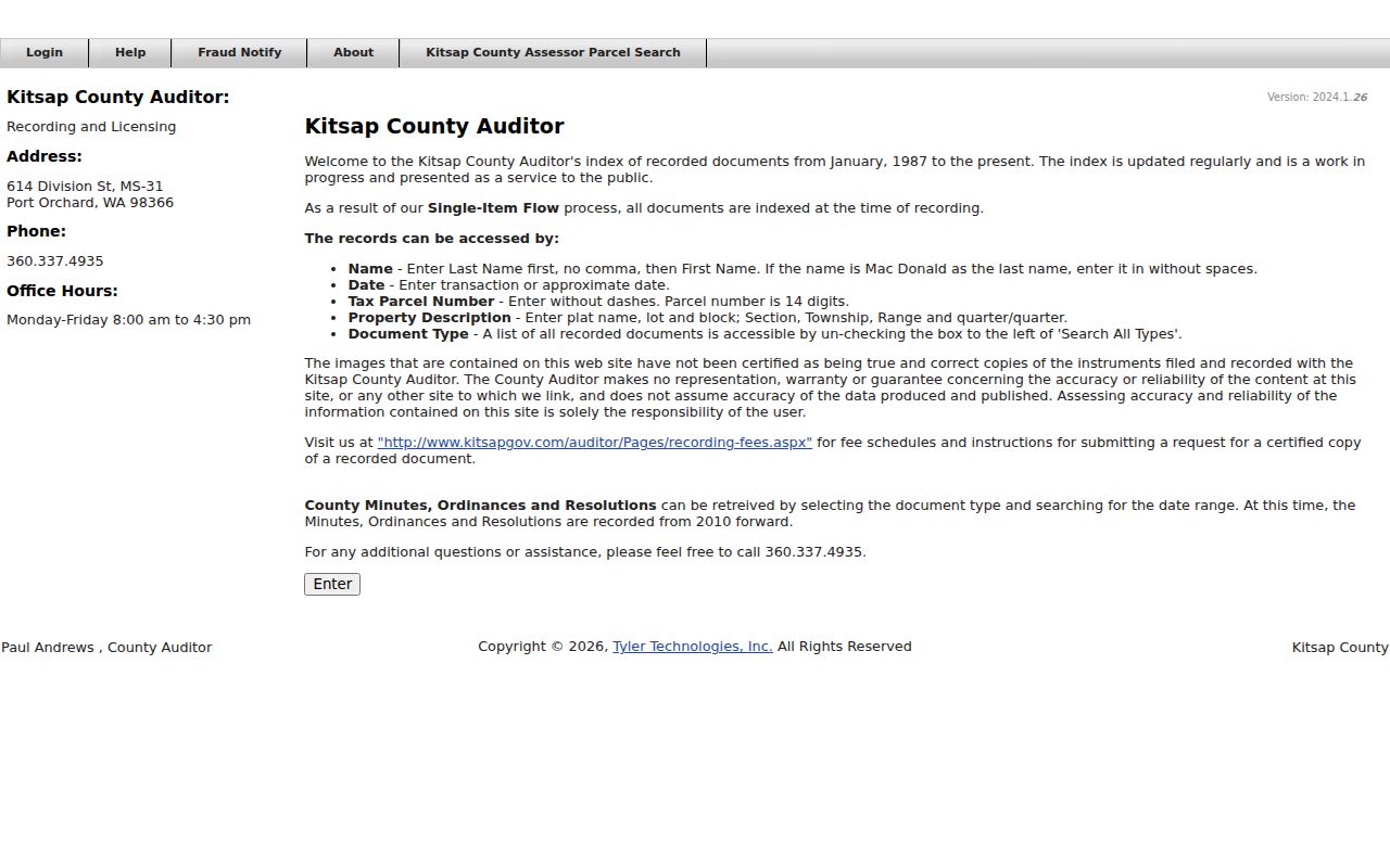
For deeds older than the web cutoff, take the parcel's legal description to the Auditor's office and the Washington State Archives. Do not assume the online endpoint is the beginning of the land record.
The linked EagleWeb help screen also shows how the name and property controls fit together.
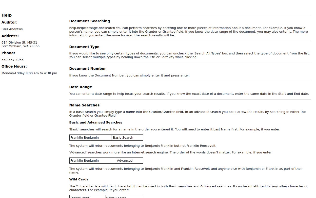
Use those controls to keep a similarly named party or plat from entering the wrong Bremerton parcel chain.
Bremerton Block Permit Timeline
Kitsap DCD's permit and code records add dated work to an address search. Its Permit Explorer maps SmartGov permits submitted from January 1, 2020 and updates weekly. Search by address or parcel, then filter by permit type, jurisdiction, and date. The Near Me tool draws a radius around a point, which is useful for comparing work across a Bremerton block.
Approved electronic permit records are described as available from 2018 forward. Older or non-indexed files go through the DCD Public Records Center by online request, email, phone, or mail to 614 Division Street MS-20 in Port Orchard. City-issued work belongs with Bremerton's records route after the jurisdiction checker confirms the parcel lies within city limits.
Permit activity can date an addition, demolition, land-use review, or code matter. It does not identify every occupant. Attach the permit number and jurisdiction to the research note so the address record does not merge county and city files.
Note: The 2025 Permit Explorer and PREP work earned national county recognition, making it a timely address-based source for Kitsap parcels.
Bremerton Addresses Beyond City Limits
A Bremerton mailing label does not guarantee a parcel is inside Bremerton. The city explicitly warns that many postal addresses lie in unincorporated Kitsap County. USPS delivery geography, city jurisdiction, and county parcel geography measure different things. That is why a by-address search should preserve the source label rather than turning every occurrence of “Bremerton” into a claim of city residence.
Use three checks. Verify the deliverable address through USPS. Test city jurisdiction in Bremerton GIS. Then confirm the parcel's site address in the county system. The result decides whether permit and public-record questions go to the city or Kitsap DCD. It also prevents a by-street search from dropping an address merely because city and county maps use different boundaries.
Boundary key. Postal city, municipal limits, and tax parcel jurisdiction can disagree without any source being wrong.
Bremerton Street Voter Records
VoteWA is an identity-matched portal for a registrant's own profile. It requires first name, last name, and date of birth. It is not a public browse-by-street roster. A separate voter file may disclose name, address, political jurisdiction, gender, year of birth, voting record, registration date, and registration number under RCW 29A.08.710, subject to protected-address and under-18 limits.
Request-based access belongs with Kitsap Elections, not with repeated guesses in VoteWA. State law restricts voter-file use, and a voting record shows participation rather than a ballot choice. Treat an address match as dated registration evidence. It does not list all adults, children, or other household members.
Historic Bremerton Streets and Aliases
Older street research needs place-name flexibility. William Bremer's townsite was platted in 1891, and Bremerton incorporated in 1901. Charleston began as Port Orchard No. 2 in 1891, took the Charleston name in 1903, and was later absorbed by Bremerton. Manette grew from an earlier settlement and became part of the city's later geography. A person or parcel may therefore appear under Bremerton, Charleston, Manette, or Port Orchard.
The State Library lists intermittent Bremerton city directories from 1909 through 2009 and separate telephone books from 1941 through 2011. Regional volumes may include nearby communities. Use the address or street section when available, but confirm exact reverse-directory holdings with Kitsap Regional Library genealogy staff. The full shelf and year runs belong on the Bremerton city directory page.
A missing directory year is not evidence of an empty house. Bridge gaps with deeds, census schedules, newspaper microfilm, and permit dates. Preserve the printed spelling and abbreviation before translating it into a modern street name.
Limits of Bremerton Street Records
Public street records show parcels, taxpayers, recorded interests, permits, and selected registration fields. They do not form a live household list. Renters and family members may never appear in a deed or parcel card. Utility customer data and driver address records are not open street-directory substitutes. Washington's Address Confidentiality Program can replace a qualifying person's actual address in public-facing records.
Commercial people-finder results can be stale, mixed between people with similar names, or stripped of source dates. Official records are narrower but state who keeps the record and how to obtain a copy. Use the official source for the fact it maintains, then verify conflicts with the custodian.
Lawful use. Use Bremerton address records for lawful personal research. Never use them to stalk, harass, intimidate, or harm anyone.
A current Bremerton address chain should keep each source date distinct. Accuracy comes from restraint: taxpayer is not owner, owner is not occupant, and one dated listing is not a complete household.