
Bremerton Neighbors Block Sources
Public files describe pieces of a Bremerton block, not a complete list of households. Start with geographic records, then choose a second source based on the question. A parcel map shows lot relationships. A parcel card names the taxpayer of record. A permit can date recent work, while a neighborhood group supplies a human contact route without exposing a private membership list.
| Source | What It Shows About a Block | Access |
|---|---|---|
| Kitsap Parcel Search Map | Nearby lots, taxpayer, account and address links | Free viewer |
| Kitsap Parcel Details | Site, mailing, taxpayer and assessment fields | Free web search |
| Bremerton GIS | Jurisdiction, zoning, districts, utilities and aerials | Free city portal |
| Voter file | Disclosable voter fields under state law | Request-based; protected records excluded |
| Neighborhood groups | Public contacts and community activity | City directory and group sites |
Owner and occupant are not synonyms. A mailing address may differ from the site address, and the taxpayer may not hold legal title. Renters and other household members normally do not appear on a parcel card. Keep those limits visible throughout any search for nearby Bremerton neighbors.
Map Bremerton Neighbors by Parcel
The Kitsap Parcel Search Map is the practical starting point. Find the known lot, click its shape, and use the card to move outward. Each adjacent polygon represents a tax parcel. The map links geographic position to taxpayer, account, site-address, and mailing-address details.
- Locate the known address and confirm its street and parcel shape.
- Click the lots that share a side, rear line, or street frontage with it.
- Open each parcel detail and record taxpayer, site address, mailing address, and account number as separate fields.
- Use the ownership or deed link only when legal ownership must be confirmed.
- Repeat in a small radius, stopping when the search reaches a different block or jurisdiction.
This process keeps the inquiry focused on the immediate block. For a complete named-street chain, use the Bremerton street directory, which follows parcels and deeds beyond the nearby radius.
- Parcel
- A tract tracked under one county tax account.
- Site address
- The physical location of the parcel, also called the situs address.
- Mailing address
- The place where the county sends the tax bill; it may be elsewhere.
- Taxpayer of record
- The name on the assessment account, which Kitsap says does not by itself prove title.
Read Nearby Bremerton Parcel Cards
Kitsap Parcel Details accepts a full or partial parcel number, tax account, street name, and optional house number. A broad street-only query may return more hits; adding the house number then narrows the result. This is useful when the entered address has a suffix or format that differs from the county record.
A result can expose the site address, mailing address, taxpayer name, account number, current and prior assessment links, sales information, ownership or deed search, and map location. Those are property facts. They do not prove which family members, guests, or renters occupy the home. Kitsap also warns that its GIS lines are not a legal survey. Recorded plats, surveys, or a surveyor control legal corners.

The county map image shows the visual route from one address to the parcels beside it. The linked parcel card, not the polygon alone, supplies the named tax-account fields.
Check Bremerton Block Jurisdiction
A postal address that says Bremerton can lie in unincorporated Kitsap County. Use the Bremerton GIS Portal to check city jurisdiction before assuming that city permits, council districts, or services apply. The portal offers Bremerton Properties, jurisdiction, zoning, district, aerial, and utility layers. Its aerial choices span 1994 through 2023, but those pictures are not a resident index.
The county parcel map and city jurisdiction checker answer different questions. County tools identify the tax parcel across Kitsap. City tools show whether the site is inside Bremerton and which municipal layers cover it. Utility map information can be requested by address or by street and block at 360-473-5270, but customer account details are not a public directory.
Boundary check. Confirm the parcel in the county viewer and its city status in Bremerton GIS before contacting an office.
Recent Change Around Bremerton Neighbors
Kitsap’s 2025 Permit Explorer and PREP mapping work adds an especially useful block view. The tool searches county permits by address or parcel and includes a Near Me function for a radius around a selected point. Records for permits submitted from January 1, 2020 forward appear in Permit Explorer and the map is updated weekly. County electronic request guidance covers permits from 2018 forward.
The Near Me result can show whether several nearby parcels have recent projects without claiming who occupies them. Search controls include address, parcel, jurisdiction, permit type, status, and date. Older work may require a Department of Community Development records request because no verified public cutoff for every earlier paper file was found.
Note: A permit names applicants or project contacts for the work; it is not proof of a current household.
Bremerton Neighbors in Civic Groups
The city’s Neighborhoods page names two established contacts: the Manette Neighborhood Coalition and Union Hill Neighborhood Association. These groups are community routes, not government resident rolls. Their public pages can help with meeting notices, projects, and local questions, but no verified public member list should be assumed.
Manette Neighborhood Coalition
Use the organization link supplied by the City of Bremerton for current public meetings and neighborhood contact information.
Union Hill Neighborhood Association
Use the city-listed association route for public community activity and the group’s current contact channel.
Neighborhood Watch
The Bremerton Police Community Resource Specialist helps residents start a watch group at 360-473-5231.
The public city page below is the safest starting point for the two named associations.
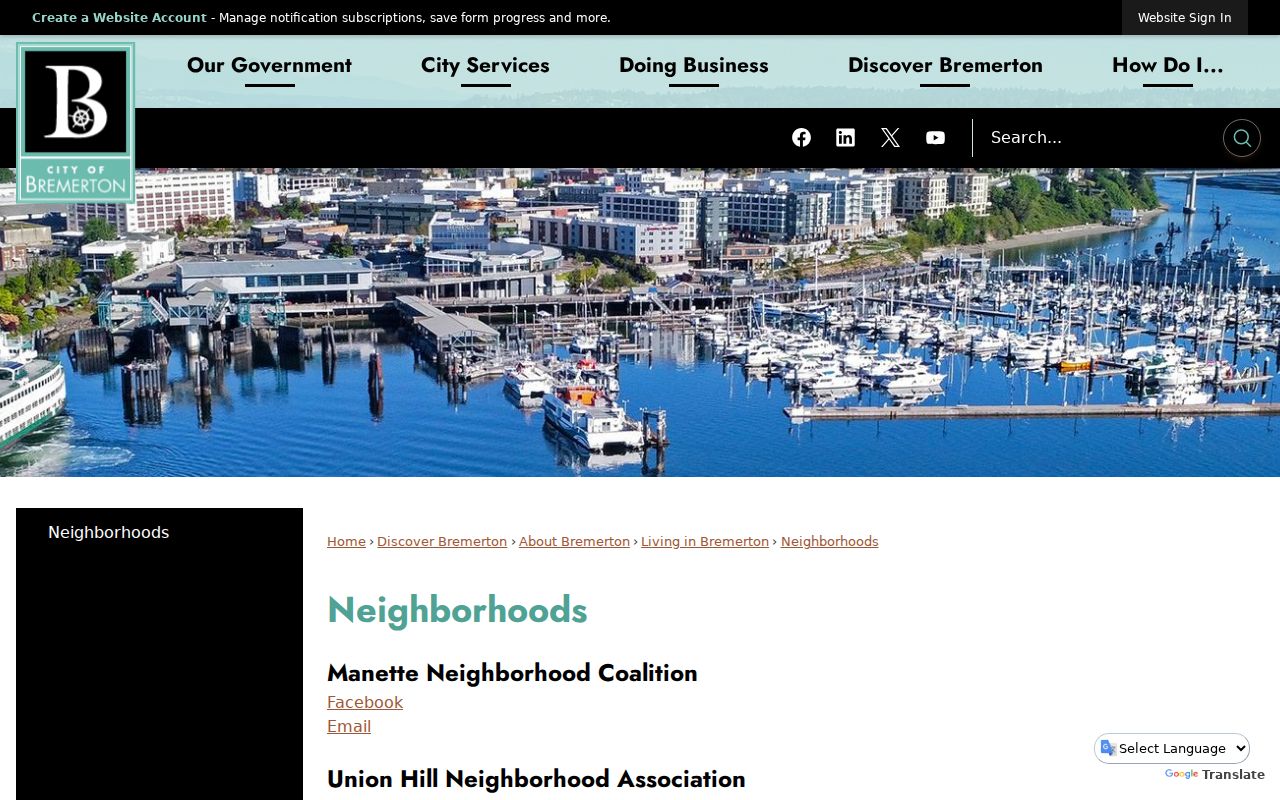
The image confirms the city’s current directory layer while avoiding any claim that private group membership is open.
Bremerton Neighbors and Voter Data
VoteWA is an identity-matched self-service portal. A registrant enters first name, last name, and date of birth to reach their own profile. It cannot be browsed as a public map of nearby voters. Kitsap Elections, at 619 Division Street in Port Orchard, handles the separate public-record channel.
RCW 29A.08.710 identifies disclosable voter-file fields such as name, address, political jurisdiction, gender, year of birth, voting record, registration date, and registration number. Protected-voter exceptions apply, and the original registration form remains confidential. Voter records can indicate registration at an address but cannot name every occupant or prove who is present now.
| Official source | Strength | Limit |
|---|---|---|
| Parcel and GIS records | Named custodian, mapped lot, current tax fields | Owners or taxpayers, not all occupants |
| Voter public record | Statutory fields and registration context | Request rules and protected voters |
| Commercial neighbor tools | May combine broad old sources | Unclear dates, roles, and correction paths |
Official rolls are narrower but explain what each label means. Commercial tools may merge stale facts and should never replace verification with the office that keeps the source record.
Historic Bremerton Neighbors by Block
For earlier households, Kitsap Regional Library provides microfilm, an obituary request, and genealogy help. The State Library catalog confirms Bremerton city directories from 1909 through 2009 with gaps, plus telephone-book runs from 1941 through 2011. Ask KRL or the Puget Sound Genealogical Society whether a given volume has a reverse street section before expecting an address-to-name search.
Place labels matter. Manette and Charleston can appear as distinct names in older material, and “Bremerton” directories sometimes cover nearby communities. Record each adult listed at the address, compare the prior and next available volume, then use an obituary or census to test family links. A directory year shows a published listing, not an exact move date.
Privacy for Bremerton Neighbors
No open official block file lists all residents, phone numbers, family ties, utility customers, vehicle registrations, guests, or renters. Washington’s Address Confidentiality Program gives eligible survivors and certain protected workers a substitute address and safeguards related voter and marriage records. Sealed court files and confidential vital records create other proper gaps.
Use public contacts when the goal is civic connection. Ask the city-listed association about an open meeting or call the Neighborhood Watch resource specialist. For record errors, contact the Assessor, Elections office, court, or other custodian rather than repeating a doubtful match.
Lawful use. Research Bremerton neighbors for civic connection, personal safety, or history. Never watch, stalk, threaten, harass, or harm anyone.